


Cross Keys Voting District, Union County, South Carolina
About
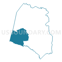
Outline

Summary
| Unique Area Identifier | 666853 |
| Name | Cross Keys Voting District |
| County | Union County |
| State | South Carolina |
| Area (square miles) | 73.09 |
| Land Area (square miles) | 73.07 |
| Water Area (square miles) | 0.02 |
| % of Land Area | 99.98 |
| % of Water Area | 0.02 |
| Latitude of the Internal Point | 34.63958110 |
| Longtitude of the Internal Point | -81.75093360 |
Maps


Graphs
Select a template below for downloading or customizing gragh for Cross Keys Voting District, Union County, South Carolina


Neighbors
Neighoring Voting District (by Name) Neighboring Voting District on the Map
- Black Rock Voting District, Union County, SC
- Buffalo Box 1 Voting District, Union County, SC
- Clinton No. 1 Voting District, Laurens County, SC
- Cross Anchor Fire Station Voting District, Spartanburg County, SC
- East Buffalo Voting District, Union County, SC
- Enoree First Baptist Voting District, Spartanburg County, SC
- Excelsior Voting District, Union County, SC
- Long Branch Voting District, Laurens County, SC
- Mt. Calvary Presbyterian Voting District, Spartanburg County, SC
- Putnam Voting District, Union County, SC
Top 10 Neighboring County Subdivision (by Population) Neighboring County Subdivision on the Map
- Union CCD, Union County, SC (17,424)
- Clinton CCD, Laurens County, SC (14,740)
- Pauline CCD, Spartanburg County, SC (10,992)
- Enoree CCD, Spartanburg County, SC (4,464)
- West Springs CCD, Union County, SC (2,069)
- Cross Keys CCD, Union County, SC (1,244)
Top 10 Neighboring Unified School District (by Population) Neighboring Unified School District on the Map
- Union County School District, SC (28,961)
- Laurens School District 56, SC (20,726)
- Spartanburg School District 4, SC (18,439)
Top 10 Neighboring State Legislative District Lower Chamber (by Population) Neighboring State Legislative District Lower Chamber on the Map
- State House District 33, SC (32,160)
- State House District 42, SC (31,209)
- State House District 15, SC (30,253)
Top 10 Neighboring State Legislative District Upper Chamber (by Population) Neighboring State Legislative District Upper Chamber on the Map
- State Senate District 9, SC (95,114)
- State Senate District 13, SC (92,248)
- State Senate District 17, SC (88,026)
Top 10 Neighboring 111th Congressional District (by Population) Neighboring 111th Congressional District on the Map
Top 10 Neighboring Census Tract (by Population) Neighboring Census Tract on the Map
- Census Tract 304, Union County, SC (6,052)
- Census Tract 238.02, Spartanburg County, SC (5,634)
- Census Tract 9206, Laurens County, SC (4,700)
- Census Tract 237, Spartanburg County, SC (4,464)
- Census Tract 307, Union County, SC (3,313)
- Census Tract 305, Union County, SC (2,186)
Top 10 Neighboring 5-Digit ZIP Code Tabulation Area (by Population) Neighboring 5-Digit ZIP Code Tabulation Area on the Map
- 29379, SC (19,186)
- 29325, SC (15,222)
- 29335, SC (5,654)
- 29178, SC (3,377)
- 29321, SC (2,596)
- 29331, SC (142)